Flooding hits Northern Ireland amid rain warning as Storm Ciaran approaches
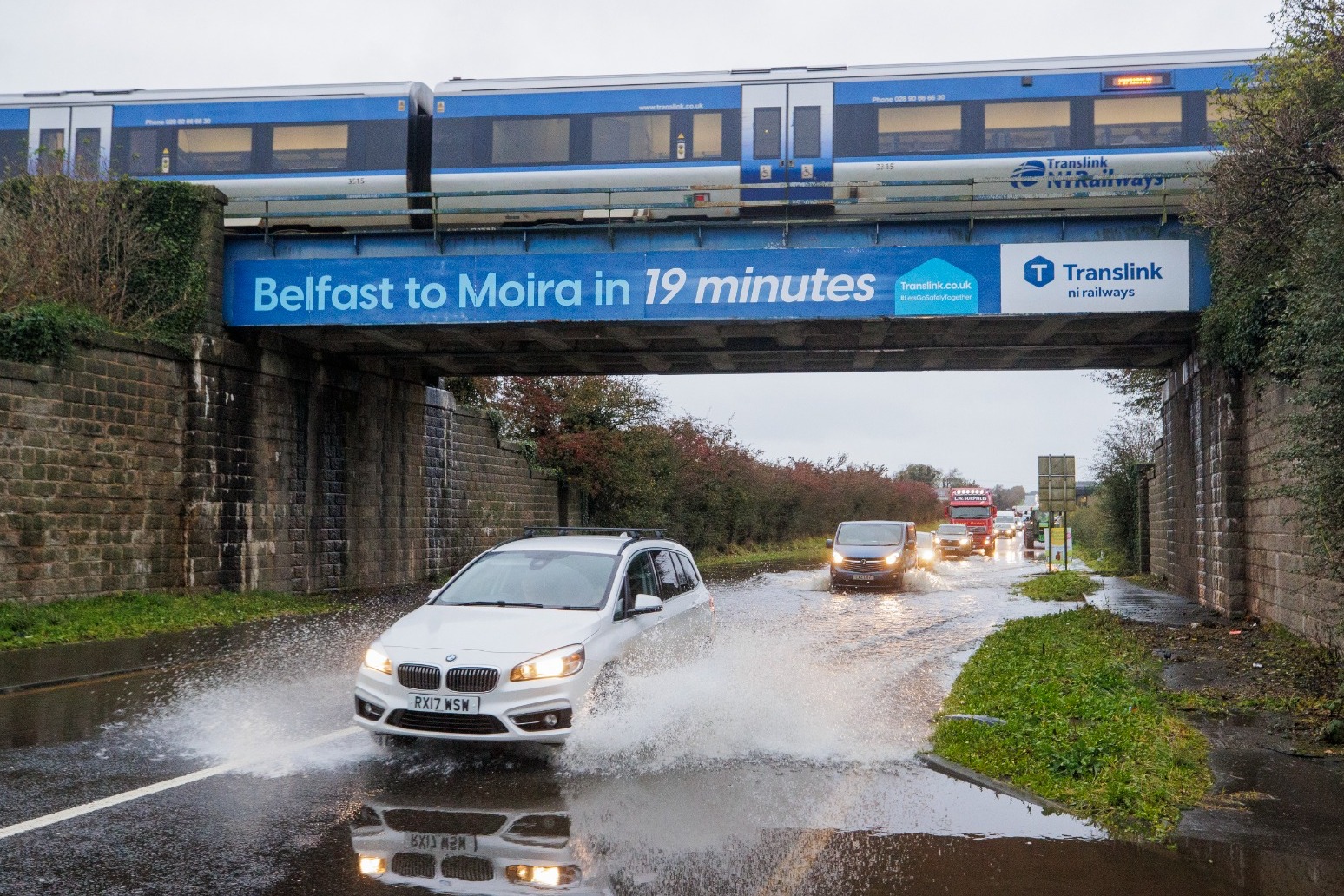
Flooding has been reported in parts of Northern Ireland as police urged people against travelling due to an amber rain warning.
More than 25 flood warnings have been issued for the UK before Storm Ciaran is forecast to bring strong winds and heavy rain to parts of England and Wales.
The Met Office warning for Northern Ireland is the second highest level and covers Counties Antrim, Down and Armagh. It occurred at 9pm on Monday and lasts until 9am on Tuesday.
It forecasts persistent heavy rain leading to flooding and transport disruption, while a yellow warning covers the rest of Northern Ireland.
There were reports of flooding in Newry in Co Down on Monday after the city’s canal burst its banks.
Elsewhere, roads have been closed due to flooding, while in Dromantine, Co Down, approximately 100 sheep had to be rescued on Monday after becoming stranded in a flooded field.
The Met Office has warned of between 25mm and 50mm of rain in places, and up to 100mm is also possible over higher ground.
Met Eireann says spot flooding is expected in Ulster throughout the morning before clearing slowly northwards.
Stormont’s Department for Infrastructure said police were warning people not to travel while the amber warning is in effect.
It said: “These (Met Office) warnings follow an extremely wet weekend where flooding has already occurred on many roads.
“The persistent wet conditions on saturated ground and with higher river levels this will inevitably lead to more localised flooding. Traffic disruption is possible, and the public are being asked to consider their journeys and take extra care if travel is necessary.
“It may be necessary to close roads or put temporary restrictions in place.”
The Police Service of Northern Ireland said: “Persistent heavy rain will lead to further flooding, and we would ask the public to take steps to minimise risk.
“Please stay at home where possible and do not make unnecessary journeys. If you must travel, please bear the prevailing conditions in mind.
“Reduce your speed and drive with extra caution. Excess surface water could lead to aquaplaning, and there is the potential for cars to get stuck in just a few inches of floodwater. Visibility is likely to be severely reduced.
“Consider the potential risks before you leave. Do not place yourself or others in unnecessary danger.”
Across the UK, the Environment Agency has issued more than 25 flood warnings ahead of the arrival of Storm Ciaran on Wednesday, while the Met Office has issued yellow weather warnings for rain from Monday until Thursday.
Gusts of 80mph are possible along the south coast of England, with 20 to 25mm of rain expected across southern and western areas, but potentially up to 40 to 60mm over higher ground, the Met Office said.
The forecaster advises the latest rain could lead to disruption to roads and public transport while already flood-affected areas after Storm Babet could get worse.
Marco Petagna, a Met Office meteorologist, said: “We’ve had various warnings in force across the UK over the last few days, and there are plenty more being issued for the next couple of days.
“The main focus in the next day or two is towards the east of Scotland and north-east England, where there is a yellow rain warning until 3am.
“There will be persistent rain up there, and then the focus for heavy showers will be across parts of southern and southeastern England and south Wales as well as parts of Northern Ireland with some heavy and sudden showers.”
He said Tuesday was expected to be still unsettled but quieter before heavy winds and longer spells of rain develop on Wednesday night into Thursday as Storm Ciaran arrives.
“There are possible gusts of 80 to 90 miles an hour in some exposed southern areas. It’s probably quite a nasty storm this one.”
Kate Marks, flood duty manager at the Environment Agency, said: “We urge people to stay safe on the coast and to remember to take extreme care on coastal paths and promenades.
“Flooding of low-lying coastal roads is also possible and people must avoid driving through floodwater, as just 30cm of flowing water is enough to move your car.”
Met Office deputy chief meteorologist Chris Almond said: “Winds associated with Storm Ciaran are likely to gust to 80mph along the south coast of England, with a small risk of somewhere exposed seeing 90mph, and winds could even gust up to 50 or 60mph further inland.
“This deep, low-pressure system will also bring heavy rain to much of the UK, but the heaviest rain is expected in southern and western areas, with 20 to 25mm quite widely across the region but up to 40 to 60mm potentially over higher ground.
“Heavy and persistent rain will fall onto the already saturated ground, bringing a risk of further impacts such as flooding in areas that are already struggling to clean up from the heavy rainfall we have seen over the last week or so.”
Published: by Radio NewsHub